Rif Mountains hiking: Akchour waterfalls and Talassemtane park
Is it safe to hike in the Rif Mountains near Chefchaouen?
Yes, on the established routes — particularly Akchour and Talassemtane National Park trails. The Rif is a cannabis-growing region and walking off marked routes or into fields is strongly inadvisable. Stick to known trails or go with a licensed local guide and the experience is safe and remarkable.
Northern Morocco’s underestimated mountain range
The Rif Mountains are the least visited of Morocco’s three main ranges — less iconic than the High Atlas, less accessible than the Middle Atlas, and carrying a reputation that keeps some visitors at arm’s length. That reputation has two sources: the density of cannabis cultivation in parts of the range, and the limited infrastructure compared to the well-developed Toubkal trekking circuit.
Both concerns are manageable with information. The cannabis-growing areas of the central Rif are genuinely not places to wander independently, but the established trekking areas — Akchour and the Talassemtane National Park, directly accessible from Chefchaouen — are safe, well-marked, and extraordinarily beautiful. What the Rif offers that the High Atlas cannot: dense cedar and fir forest, dramatic river gorges with swimmable pools, dramatic limestone ridges, and almost no other foreign trekkers.
This guide covers the two main hiking options from Chefchaouen — the popular Akchour day trip and the quieter Talassemtane multi-day routes — with honest safety information, route details, and logistics.
Understanding the Rif: geography and context
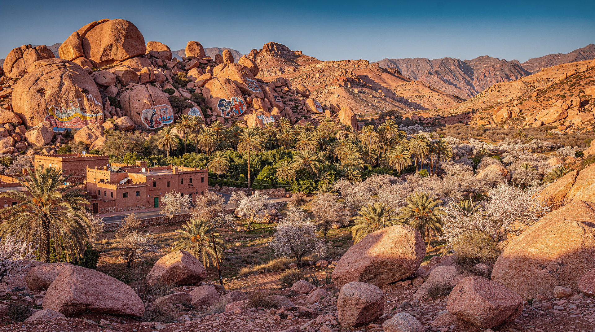
The Rif Mountains form a crescent running northeast to southwest across northern Morocco, from the Mediterranean coast near Al Hoceima to the Atlantic approaches near Tetouan. The highest point is Jebel Tidighine at 2,448m. Chefchaouen sits on the southwestern edge of the range, in a cirque valley at approximately 600m elevation.
The range receives significantly more rainfall than the Atlas mountains — the northern slopes catch Atlantic and Mediterranean moisture, producing dense mixed forest (cedar, fir, thuya, holm oak) that is rare in Morocco’s generally arid landscape. The rivers that drain the range are perennial and clear, with multiple waterfall complexes and natural swimming pools.
The cannabis context: The Ketama area and surrounding highlands of the central Rif have been Morocco’s primary cannabis-producing region for decades. Production is technically illegal but tolerated in practice. The principal risk for visitors is not violence but harassment from farmers protecting their fields, requests for payment to pass, or encounters with traffickers who are suspicious of people in the hills above their operations.
The key point: Akchour and Talassemtane are not in or near the cannabis-growing areas. They are on the western edge of the Rif, directly accessible from Chefchaouen, and have established tourist infrastructure. Walking into unmarked terrain in the central or eastern Rif is a different matter.
Akchour: the classic Rif day trip
Overview
Akchour is the most popular hiking destination from Chefchaouen — a gorge and waterfall complex approximately 25km northeast of the city, accessible by road and then on foot. The main attraction is the Cascades d’Akchour (Akchour Waterfalls), a pair of impressive falls in a narrow limestone gorge. A second trail leads to a natural arch (God’s Bridge / Pont de Dieu) about 2.5 hours further upstream.
The combination of good access, clear trails, swimming opportunities, and dramatic scenery makes Akchour extremely popular in spring and summer. You will share the trail with Moroccan families, European day visitors from Chefchaouen, and the occasional longer-distance trekker.
The lower falls route (easy, 2.5–3 hours round trip)
Distance: 6–8km return
Elevation gain: 200m
Difficulty: Easy — flat river path with some rocky sections
Suitable for: Almost everyone, including children comfortable on uneven terrain
The path follows the Oued Farda river from the parking area at the road-end through a series of narrow gorge sections. The lower falls (approximately 30m) are reached after 1–1.5 hours. There are natural pools below and beside the falls that are swimmable in spring and summer (water temperature: cold but bearable from May onwards).
Several small café stalls operate along the route and at the falls, selling tea, snacks, and simple meals. The setting is postcard-perfect — the white limestone walls of the gorge, the cedar and oak overhang, and the falls themselves.
The God’s Bridge extension (moderate, full day)
Distance: 14–18km return
Elevation gain: 600m
Difficulty: Moderate — sustained climbing on good paths, some rocky sections
Duration: Full day from Akchour parking area (6–8 hours)
Continuing upstream from the lower falls, the trail climbs more steeply into the gorge interior. The terrain becomes more demanding — narrower paths, steeper sections, occasional river crossings on stepping stones. The upper falls (higher than the lower, less visited) are reached after another 1.5 hours.
Beyond the upper falls, the trail continues to God’s Bridge — a natural limestone arch spanning the gorge at approximately 900m elevation. The arch is genuinely impressive: 25m high and 15m span, formed by the river cutting through a limestone ridge over millions of years. The views from the top of the arch down into the gorge are among the best in northern Morocco.
Return route: The return follows the same path. Allow 2.5–3 hours back from the bridge to the parking area. Carry food and water — the trail cafés thin out above the lower falls.
Guided Akchour tours
Guided day trips from Chefchaouen are the most convenient option, handling transport (the road to Akchour requires a 4WD or a van) and including a local guide who knows the river crossing points and the best swimming spots.
Book an Akchour waterfalls day trip from ChefchaouenFor a more focused hiking experience with guidance on the full gorge system:
Book a guided Akchour waterfall hike from ChefchaouenGetting to Akchour independently
By shared taxi: From Chefchaouen’s main taxi stand (near the bus station below the medina), shared grand taxis run to Ain Tissimane (5km short of Akchour) for 15–20 MAD per person. From there, continue by foot (1 hour) or hire the taxi exclusively for the full route (80–120 MAD for the car).
By car: The road from Chefchaouen to Akchour is partially paved and partially track — a standard car can manage it in dry conditions, but a high-clearance vehicle is more reliable for the final section. Ask your accommodation for current road conditions.
What to bring: Swimwear (the pools are excellent), water shoes or sandals for river crossings, 2L water per person, sun protection, and a light layer for the shaded gorge sections.
Talassemtane National Park: off-grid hiking
Overview
Talassemtane National Park covers 58,950 hectares of the western Rif immediately north and east of Chefchaouen. It is one of Morocco’s most ecologically important protected areas — the park contains the largest remaining stands of Moroccan fir (Abies marocana), a species found nowhere else in the world, alongside cedar, holm oak, and a diverse endemic flora.
The park’s trail network is less developed than Akchour but more extensive — several multi-day routes cross the park’s interior, and a day-hike network accessible from Chefchaouen reaches viewpoints and forest areas not visited on the standard Akchour route.
Day hike: Ras el-Maa and Jbel Tissouka (moderate, 4–5 hours)
Distance: 12km loop
Elevation gain: 800m
Difficulty: Moderate — sustained climbing on clear paths
Starting point: Ras el-Maa spring, upper Chefchaouen medina
Starting from the picturesque Ras el-Maa spring at the top of the medina (where the laundry women still wash clothes in the natural water), the trail climbs through the scrub oak forest above the city to reach the Jbel Tissouka ridge at 1,979m. The view from the ridge — Chefchaouen below, the Atlantic visible on clear days to the west, and the Rif interior to the east — is one of the finest viewpoints in northern Morocco.
The loop descends through the cedar forest on the reverse slope, returning to Chefchaouen via the Spanish mosque (accessible from the medina) for a natural circuit.
Guide required? The route to Jbel Tissouka is clear in the lower section but requires basic navigation skills above the tree line. A local guide adds detail and confidence, and is recommended for a first visit.
Multi-day trekking in Talassemtane
The park’s interior routes range from 2 to 5 days and require proper preparation, a licensed guide, and logistical support (gîtes within the park are basic or non-existent — camping is the standard approach).
Key routes:
The Chefchaouen-Bab Taza circuit (3 days): A loop through the Moroccan fir forest, crossing the park’s highest ridge (Jbel Lakraa, 2,159m) and descending to the village of Bab Taza before returning. The fir forest sections are extraordinary — ancient trees with 2m diameter trunks in a completely silent forest.
The Oued Laou river route (2 days): Following the Laou river from its source in the park to the coast at Oued Laou on the Mediterranean. More of a point-to-point route that requires vehicle logistics at both ends but provides a complete watershed traverse from mountain to sea.
Bureau des Guides de Chefchaouen: Licensed local guides for Talassemtane trekking are registered with the local guide bureau, accessible near the tourist office in Chefchaouen. Day guide rate: 400–600 MAD. Multi-day with full logistics: 700–1,000 MAD per day.
Safety in the Rif: honest guidance
The safety conversation about the Rif Mountains is clouded by vague warnings that apply very differently to different areas. Here is the specific breakdown:
Akchour gorge: Safe for independent visitors. Well-established tourist destination, frequent foot traffic, café operators along the route who provide informal presence. No special precautions required beyond standard hiking sense.
Talassemtane park on marked routes: Safe with a guide. Route-finding complexity and the park’s density make a guide more a practical necessity than a safety requirement.
The central and eastern Rif (Ketama area): This is where the safety considerations are real. The high valleys around Ketama, Bab Berred, and south toward Al Hoceima are in the core cannabis-growing zone. Walking in fields or remote valleys without local knowledge is a genuine risk — not of violent crime typically, but of confrontational encounters with farmers protecting their crop, requests for payment to pass, or police suspicion of buyers.
The practical rule: Stay on established tourist trails around Chefchaouen. If you want to explore further into the Rif interior, use a licensed local guide from Chefchaouen who knows which areas are navigable.
Photography note: Photographing cannabis fields is inadvisable and can provoke genuinely unpleasant responses. If cannabis cultivation is visible along a route, photograph the landscape not the plants.
Seasonal considerations for Rif hiking
March to May: Ideal. The forests are green, the rivers are full from winter rains, the waterfalls are at maximum flow, and temperatures are comfortable for sustained hiking. Wildflower display in April is exceptional.
June to September: Hot in the valleys (35–40°C at river level) but cooler on the high ridges. The swimming pools at Akchour are at their best for swimming. Start early and finish by noon for valley hikes.
October to November: Second best period. The deciduous trees are in autumn colour, the Moroccan fir forest particularly beautiful. Temperatures comfortable.
December to February: The high ridges of Talassemtane see snow; the lower Akchour gorge remains walkable but is cold and can be slippery. Not recommended for casual visitors.
Combining Rif hiking with Chefchaouen exploration
Chefchaouen makes a natural 3-day base for combining the medina experience with outdoor activities:
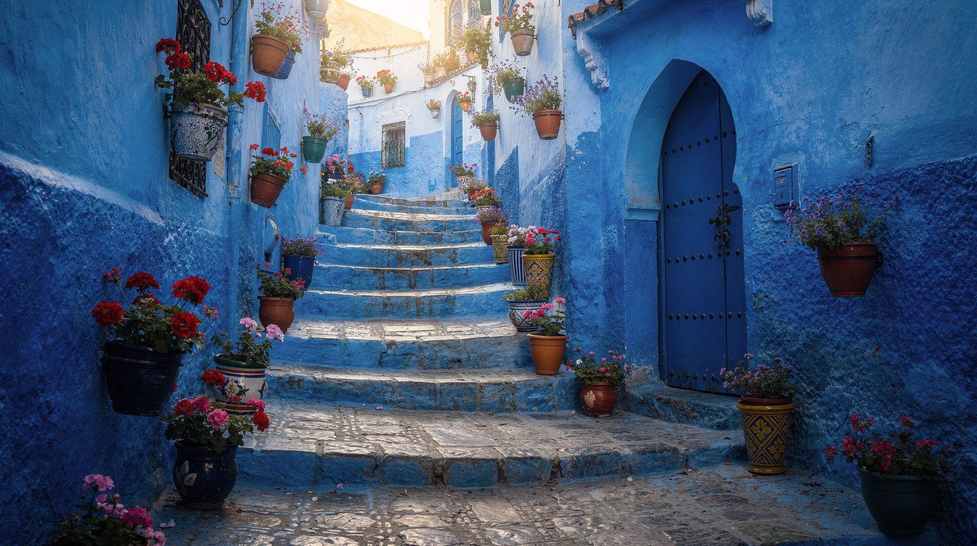
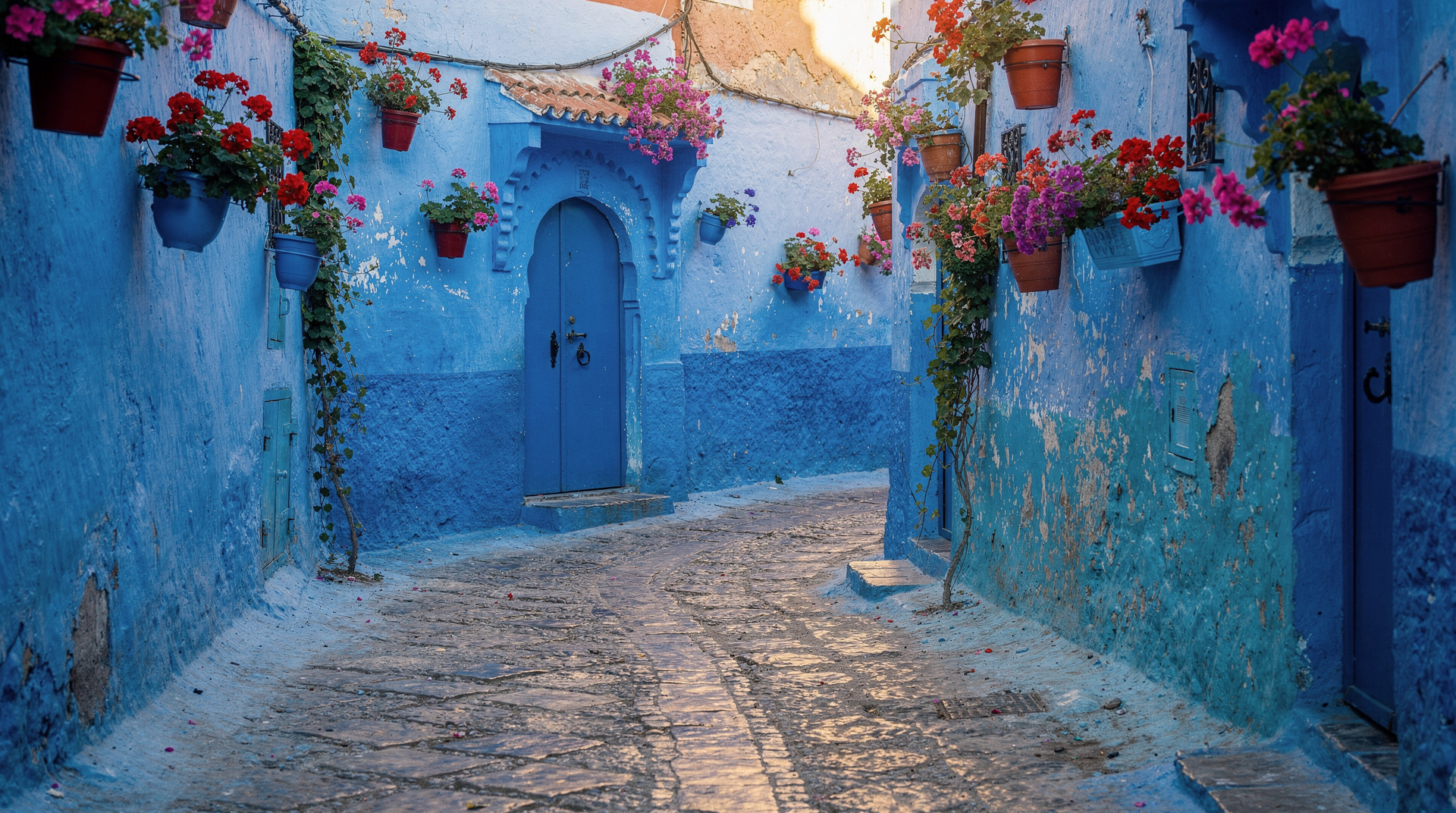
Day 1: Explore the blue medina at leisure — the Spanish mosque viewpoint in the morning, the kasbah museum in the afternoon, sunset from the terrace cafés above the main square. See the Chefchaouen shopping guide for the medina’s craft market.
Day 2: Full-day Akchour day trip (lower falls + God’s Bridge for those with energy).
Day 3: Morning hike to Jbel Tissouka and back, afternoon at leisure.
This structure makes the most of Chefchaouen without the city feeling rushed. For the destination overview — getting there, where to stay, what to eat — the Chefchaouen destination guide is the starting point.
For trekking in other parts of Morocco, the Anti-Atlas trekking guide covers the quiet southern range, and the Atlas Mountains destination guide covers the Toubkal circuit and High Atlas options.
Frequently asked questions
Can I hike Akchour without a guide?
Yes — the main gorge trail to the lower falls and up to God’s Bridge is clear and well-trafficked. The trailhead is signposted and the route follows the river. A guide adds cultural context and swimming spot knowledge but is not necessary for navigation.
Is camping allowed in Talassemtane National Park?
Camping is allowed in designated areas within the park. Wild camping in the forest is tolerated in practice but technically requires park authority permission. The Bureau des Guides in Chefchaouen can advise on current regulations and the best camp locations.
How fit do I need to be for the God’s Bridge extension?
Moderately fit — the extension adds approximately 400m elevation gain over 7km beyond the lower falls. Long but not technically demanding. The key is time: the full Akchour–God’s Bridge return is 6–8 hours. Start by 8am if you want to complete it comfortably.
Are there cafés at Akchour?
Yes — several small café stalls operate at the lower falls (seasonal, reliable in spring and summer). The area around the God’s Bridge has no café infrastructure — carry food and water for the full day route. The walk from parking area to lower falls has 2–3 stalls selling tea and snacks along the river path.