Anti-Atlas trekking guide: Tafraoute, Jebel L'Kest and beyond
When is the best time to trek in the Anti-Atlas and what makes it different from the High Atlas?
February to April is ideal — almond blossom fills the valleys, temperatures are perfect, and the light is exceptional. The Anti-Atlas is drier, lower, and far less visited than the High Atlas. Expect granite rather than limestone, open panoramas rather than deep gorges, and almost no other foreign trekkers.
The trekking region most visitors miss entirely
Ask any Marrakech tour operator about trekking in Morocco and you will hear about the High Atlas — Jebel Toubkal, the Aït Benhaddou circuit, the Mgoun Massif. These are exceptional destinations, but they attract the majority of Morocco’s trekking visitors, which means fixed routes, increasing infrastructure, and in peak season, a level of foot traffic that can make a day on Toubkal feel more like a queue than a wilderness experience.
The Anti-Atlas, three hours south of Agadir, receives a small fraction of that traffic. The range is older, geologically speaking, than the High Atlas — Pre-Cambrian granite and schist rather than Mesozoic limestone, rounded by 600 million years of erosion into a landscape that is lower, broader, and more open than the High Atlas drama of vertical gorges and 4,000-metre summits.
What this produces for the trekker: long ridge walks with 360-degree panoramas, Berber villages that see genuinely few foreign visitors, accommodation in family gîtes where the hospitality is uncomplicated by tourist economics, and in late February and March, one of the most beautiful natural spectacles in Morocco — the mass flowering of wild almond trees that turns every valley pink and white.
This guide covers the main trekking areas around Tafraoute, the Jebel L’Kest circuit, logistics for self-organising or guided treks, and the seasonal windows that determine how good the experience is.
Geography and orientation
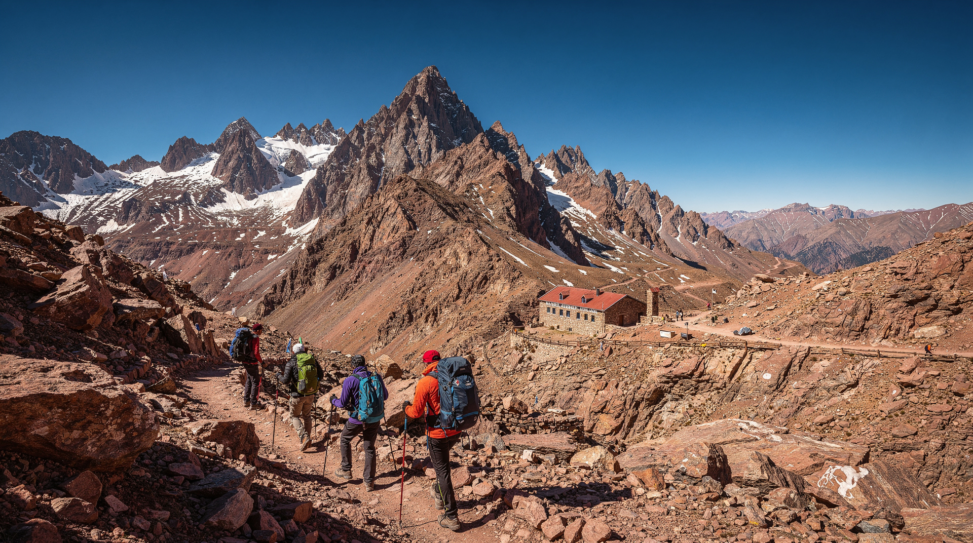
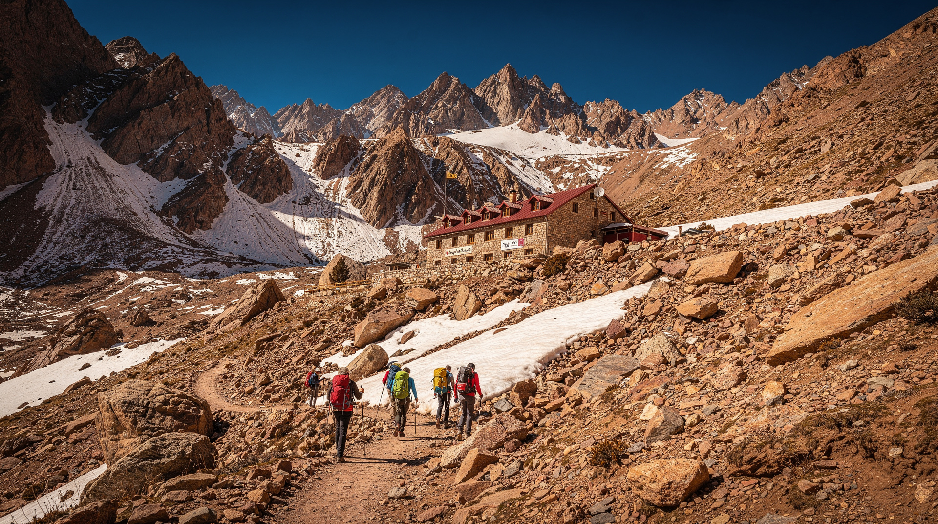
The Anti-Atlas runs roughly east-west across southern Morocco, separating the Souss Valley to the north (Agadir, Taroudant) from the Saharan foothills to the south (Tata, Akka). The highest point is Jebel Aklim at 2,531m — significantly lower than Toubkal (4,167m) — but the trekking here is not about altitude. It is about landscape, isolation, and geology.
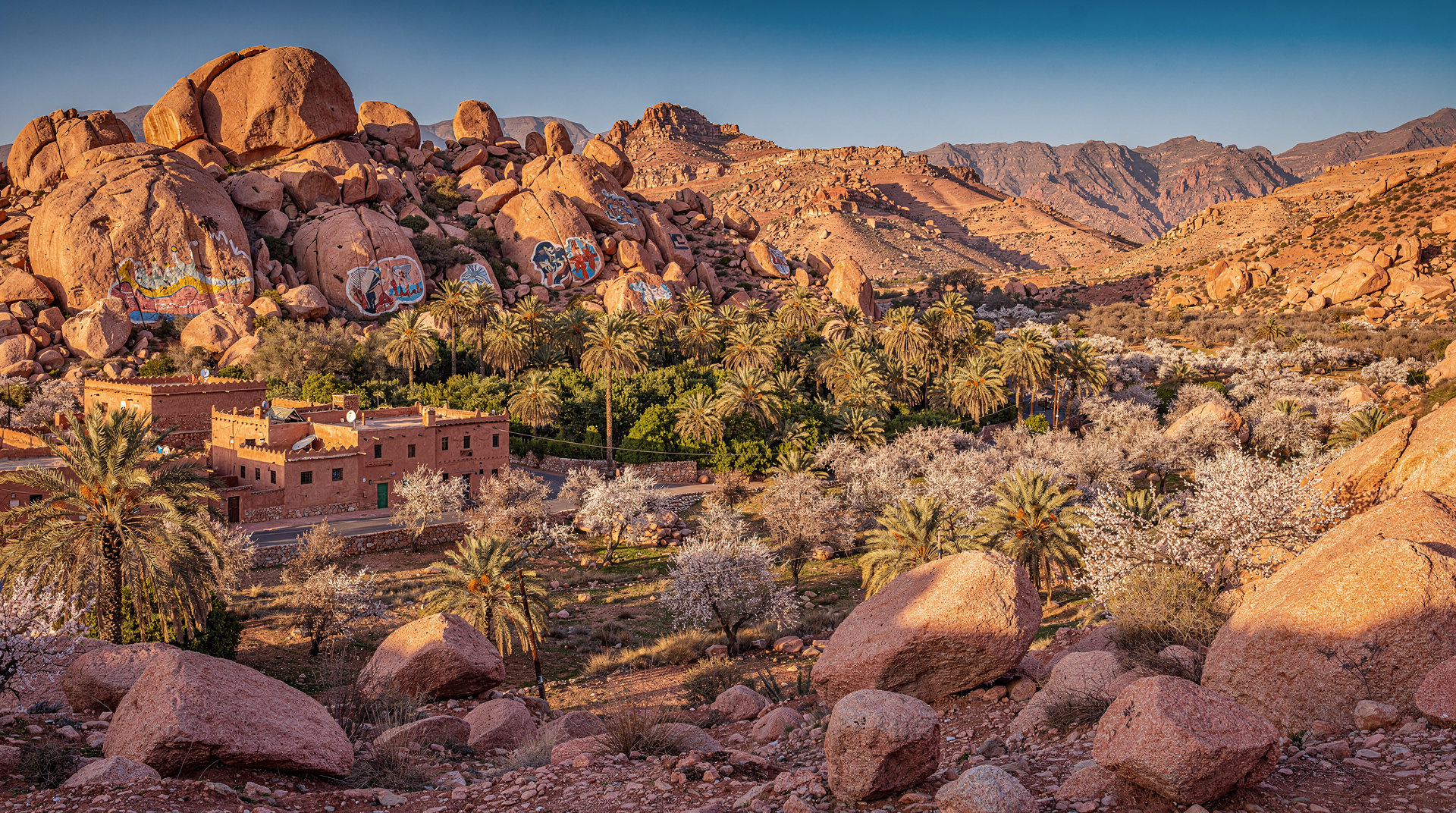
The Tafraoute basin: The main trekking hub, located in a natural amphitheatre of pink granite outcrops in the heart of the Ammeln Valley. The town itself (roughly 7,000 residents) has adequate infrastructure for trekkers: gîtes, a few simple hotels, a Tuesday and Sunday market, equipment rental from several local operators, and a guide association.
Jebel L’Kest: The dominant peak of the Tafraoute area at 2,359m. A full circuit of the L’Kest massif takes 3–4 days, crossing the range via several passes, passing through Berber agoudals (seasonal settlements), and traversing terrain that includes granite rock gardens, juniper forest, and open stony plateau. The summit of L’Kest itself is a moderate scramble rather than a technical climb.
The Ammeln Valley villages: The valley south of Tafraoute contains 26 traditional Berber villages (the Ammeln tribe) connected by mule paths and walking routes. Day walks between villages — Oumesnat, Aït Taleb, Aouint Lkhafif — give access to traditional architecture (the characteristic painted-white flat-roofed houses of the Ammeln) and domestic life that has changed relatively little in form if not in detail.
The Painted Rocks: Jean Vérame’s 1984 installation of brightly painted (red, blue, white, orange) granite boulders in the desert landscape south of Tafraoute is a minor curiosity worth an afternoon detour — the colours have faded significantly but the scale (covering several hectares of boulders) is still striking.
Best trekking season: February to April
The Anti-Atlas has four seasonal characters:
February to April (best): Temperatures at valley level: 15–22°C during the day, 5–10°C at night. On higher ground, cooler — Jebel L’Kest can see frost in February. The almond blossom peaks in late February to mid-March, transforming the valleys with pink and white flowers. Visibility is exceptional — the air is clean and the light is soft.
October to November (second best): After the summer heat. Temperatures similar to spring. No blossom, but clearer skies than spring and warm afternoons. A good alternative if spring is not possible.
December to January: Cold at altitude (snow possible on L’Kest peaks), but the lower Anti-Atlas valleys remain walkable and the almond trees are bare. A quieter time with genuine winter light.
May to September (avoid for strenuous trekking): The Souss Valley below the Anti-Atlas regularly exceeds 40°C. At altitude, the Anti-Atlas is cooler but still hot. July and August are genuinely difficult for any serious trekking.
The Jebel L’Kest circuit (3-4 days)
This is the marquee route of the Anti-Atlas — a high-level circuit around the L’Kest massif with one of the most impressive panoramas in southern Morocco from the summit plateau.
Day 1: Tafraoute to Aït Mansour Gorge
Distance: 12–15km
Elevation gain: 400m
Duration: 4–5 hours
The route leaves Tafraoute heading south and southwest through the pink granite landscape, crossing into the dramatic Aït Mansour Gorge — a narrow red canyon with a seasonal stream and a different geological character from the open plateau above. The gorge contains a small oasis of palms and a Berber village that makes a reasonable overnight stop.
Accommodation: Family gîte in the gorge village (80–150 MAD per person, dinner and breakfast included in most arrangements). Reserve through a Tafraoute guide or tour operator.
Day 2: Gorge to L’Kest approach
Distance: 10–14km
Elevation gain: 800m
Duration: 5–6 hours
The route climbs from the gorge to the L’Kest plateau via a long valley approach, passing through juniper stands at 1,800m and emerging onto the open granite plateau. The panorama from the plateau takes in the Souss Valley to the north, the Saharan hammada to the south, and on clear days, the Atlantic Ocean to the west.
The summit option: From the plateau, Jebel L’Kest summit (2,359m) involves a 2-hour return scramble on stable granite — no technical equipment required, but good footwear essential. The views add 60km of panorama over the lower route.
Accommodation: Bivouac on the plateau (carry all equipment and water) or descent to a lower village gîte. Plateau bivouac is one of the best camping experiences in southern Morocco — no light pollution, extraordinary starfield.
Day 3: Plateau traverse to northern villages
Distance: 12–16km
Elevation gain/loss: 300m gain, 800m descent
Duration: 5–6 hours
The plateau traverse heads north and northeast, descending via a long ridge route to the Ammeln Valley villages and a return path to Tafraoute. This day has the most consistent views of the circuit — the descent into the Ammeln Valley with the village cluster below is a strong photographic finish.
Optional Day 4: If you have an extra day, the northern villages of the Ammeln (Aït Taleb, Oumesnat) are worth a half-day wander before departure.
Day hikes from Tafraoute (no overnight gear required)
Amtoudi (Aguerd n’Ouzrou): 25km south of Tafraoute, an extraordinary cliff-top agadir (fortified collective granary) perched on a sheer rock face and still in use by local families. A 2-hour drive and a 1-hour hike approach. One of the most remarkable vernacular architecture sites in Morocco.
Afella Ighir: A 4-hour loop from Tafraoute over the ridge to a traditional Berber village with views back over the palm grove in the valley below. Moderate difficulty, no guide required if you have a basic trail map.
Lion Face (Rocher du Lion): A 2-hour return walk to an enormous granite boulder formation that resembles a reclining lion from the south. More tourist-oriented than the other walks but with good views from the surrounding plateau.
Logistics and practical planning
Getting to Tafraoute
From Agadir: The most common approach. CTM runs a daily bus (5–6 hours, around 80 MAD). The more scenic option is the shared taxi from Tiznit (2.5 hours, 70 MAD) — faster and more flexible, but requires getting to Tiznit first (1 hour from Agadir by CTM or shared taxi).
By car: The most flexible option. The main road from Agadir via Tiznit is paved and in good condition. From Tafraoute you can explore the surrounding valleys at your own pace. Road from Tafraoute east toward Tata (P1013) involves a spectacular descent into the anti-Atlas interior — excellent if you are connecting toward Ouarzazate or the desert.
From Marrakech: Via Agadir on the A7 motorway, then the route above. Total driving time from Marrakech: approximately 5.5 hours. An alternative inland route via Taroudant and Tiznit is slower but more scenic. For trekkers who want a guided mountain day before committing to the multi-day Anti-Atlas circuit, the Berber village and Atlas Mountains day trip from Marrakech — a full-day hike with a licensed guide through High Atlas villages, from €30pp provides a good baseline reading of your fitness and pacing before the more remote Anti-Atlas terrain.
Guides
A local guide is strongly recommended for the L’Kest circuit and advisable for any multi-day trekking in the Anti-Atlas. The terrain is not technically difficult but route-finding on the plateau is challenging without landmarks, and a local guide provides cultural access (villages that don’t commonly receive foreign visitors) that a solo trekker cannot replicate.
Bureau des Guides de Tafraoute: The official guide bureau in Tafraoute town coordinates licensed mountain guides and arranges mule support, gîte bookings, and full logistics. Day guide rates: 350–500 MAD per day. Multi-day circuit with full logistics (guide, mule, gîtes): 600–900 MAD per person per day (not including own costs).
Equipment
The Anti-Atlas does not require mountaineering equipment. For a multi-day L’Kest circuit:
- Lightweight walking boots with ankle support (the granite terrain is uneven)
- Layers — temperature swings of 20°C between plateau night and valley midday are common
- Sun protection (hat, 50+ SPF, sunglasses) — the granite plateau reflects UV efficiently
- Water capacity: 3L minimum per person per day. Water sources exist but require treatment (carry iodine tablets or a filter).
- Sleeping bag if bivouacking (rated to 0°C for February-March)
- Detailed map (IGN Morocco 1:100,000 series, available in Agadir or online)
Accommodation in Tafraoute
Hôtel les Amandiers: The best mid-range option in town, with a pool (not always filled) and panoramic terrace views. 400–600 MAD double room.
Dar Infiane: A comfortable gîte in the Ammeln Valley village of Oumesnat, run by a local family. Authentic, excellent food, and an ideal base for day walks in the valley. 150–250 MAD per person with meals.
Camping: Several informal camping sites exist south of Tafraoute near the Painted Rocks. Facilities are basic (water, sometimes a toilet block). Free or 20–40 MAD per tent.
Combining the Anti-Atlas with other destinations
The Anti-Atlas sits on natural circuits that combine well with other southern Morocco destinations:
Agadir–Tafraoute–Tata–Igherm–Taroudant loop: An excellent 5–6 day drive-and-trek circuit through the full breadth of the Anti-Atlas, combining Tafraoute trekking with the more remote Tata and Akka areas and the beautiful Taroudant medina. Beginning or ending in Agadir, the Paradise Valley day trip from Agadir with lunch — palm gorges and a Berber lunch in the pre-Atlas foothills, from €35pp makes a natural bookend to the Anti-Atlas circuit.
Tafraoute–Tiznit–Sidi Ifni–Mirleft: Heading south from Tafraoute to the Atlantic coast, connecting with the surf and beach destinations of Mirleft and Sidi Kaouki. See the Atlantic coast road trip guide for the full coastal itinerary.
Tafraoute–Ouarzazate (eastern route): The P1013 east from Tafraoute toward Tata, then north to Agdz and Ouarzazate, passes through some of the most remote and visually extraordinary landscapes in Morocco. A 2-day drive (with stops) connecting the Anti-Atlas to the gateway of the Sahara desert.
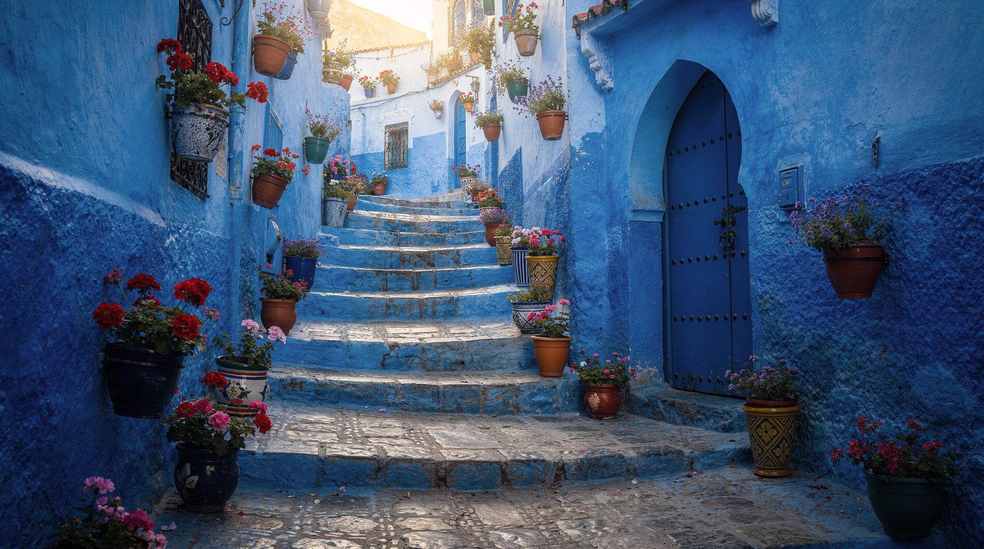
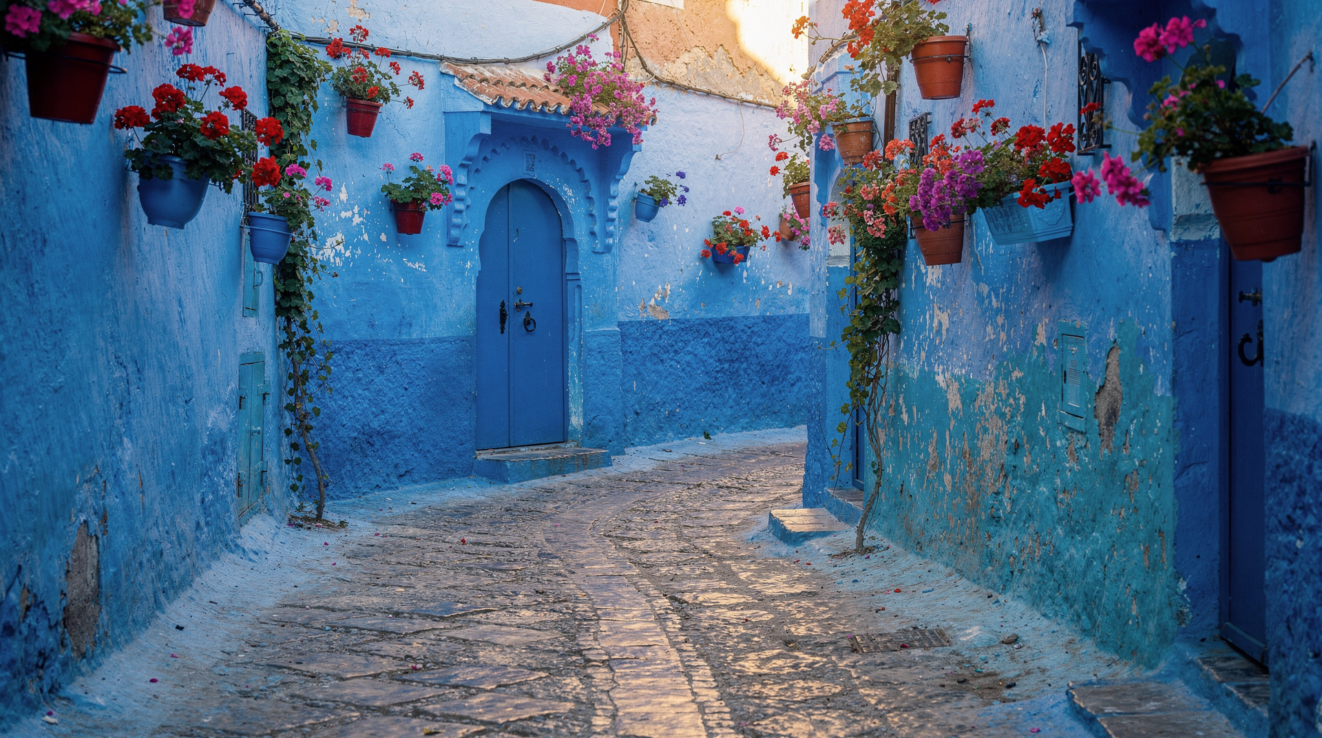
For broader hiking context, the High Atlas trekking section covers Toubkal and the main High Atlas routes. The Rif Mountains hiking guide covers northern Morocco trekking around Chefchaouen.
Frequently asked questions
Do I need a guide for the Anti-Atlas?
Not legally required, but strongly recommended for multi-day treks. Route-finding on the L’Kest plateau is genuinely challenging, and local guides provide cultural access to villages and gîtes that solo trekkers cannot easily arrange independently. Day walks from Tafraoute to marked destinations (Amtoudi, Lion Face) are manageable without a guide.
Is the Anti-Atlas harder than the High Atlas?
The Anti-Atlas is lower and less steep than the High Atlas — there are no 4,000m summits and no glaciers. The difficulty is moderate (equivalent to a challenging UK or Alpine foothills day walk) rather than serious mountaineering. The dryness and sun exposure can make the Anti-Atlas feel harder than the altitude suggests in warm months.
What language do people speak in the Anti-Atlas villages?
Tachelhit (Shilha), the Berber language of the Souss region, is the primary language in Anti-Atlas villages. French is understood by younger residents who have attended school in Tiznit or Agadir. Arabic and English are rarely spoken in the deep valleys. A guide who speaks Tachelhit transforms the experience of visiting Ammeln Valley villages.
How do I get from the Anti-Atlas to the Sahara?
The most direct route is east from Tafraoute via Tata to Akka, then north on the N12 to Zagora and the Draa Valley. Total drive: 6–8 hours. This route is remote (carry extra fuel, water, and emergency supplies) and extraordinarily beautiful.